Official Name:
阳儿堡村战国秦长城3段YangErBaoCunZhanGuoQinChangCheng3DuanOur Name:
/
Other Name:
/
Period:战国秦 / Warring States 475~221 B.C.
Location: 宁夏回族自治区,固原市,原州区,河川乡骆驼河村阳儿堡自然村东——河川乡骆驼河村阳儿堡自然村东北 / NingXiaHuiZuZiZhiQu,GuYuanShi,YuanZhouQu,HeChuanXiangLuoTuoHeCunYangErBaoZiRanCunDongHeChuanXiangLuoTuoHeCunYangErBaoZiRanCunDongBei
[
Looking Local List]
Details:长城类别:墙体
起点经纬高度:东经:106° 29′ 北纬:35° 57′ 海拔:1560
终点经纬高度:东经:106° 29′ 北纬:35° 58′ 海拔:1565
墙体走向:
墙体类别:土墙
结构特点及构筑方式:无。不清。
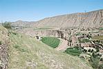
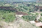
现状:此段长城沿小川河西岸台地由南向北延伸,地势较平缓,落差不大。该段墙体处于村庄内,由于建房、耕种等人为活动以及小川河河水泛滥造成的河道崩毁,墙体整体已消失,但沿线仍有少量绳纹瓦片等遗物。按其走向及保存现状分为1段:
第一段:GPS0307--GPS0308点,长800米,消失。
损坏情况及原因:
此段长城整体已消失。其损害有自然与人为两种,以自然因素为主。
自然因素主要有:
山洪雨水冲断。
此段长城所处区域水土流失严重,沟壑纵横;大部墙体被山洪冲毁。
人为因素主要有:
居民生产生活破坏
该段墙体沿线居民修路建房、修建梯田对墙体造成不同程度的破坏。
Type:土墙 Rammed earth wall
Protection Level:国保
Content:
Memo:
Other Records:
Distribution:
visit location in Tianditu Map[recommend] Distribution:
visit location in Tencent QQ Map Distribution:
visit location in Google MapDistribution:
visit location in Baidu MapNational ID:640402382101020003
Action:[
 Save in Data Basket
 ]
Picture:
Click the thumbnail to view the Big Pic. Click the Big Pic to Hide the Big Pic![Caption:阳儿堡村战国秦长城3段
loading images --Please wait...]()
![Caption:阳儿堡村战国秦长城3段
loading images --Please wait...]() Photo Links
Photo Links:
 Search ::
  Favorite/My Favorite :: Recent Changes :: :: Login