Official Name:
图们微波站关TuMenWeiBoZhanGuanOur Name:
无 / Wu
Other Name:
/
Period:金 / Jin Dynasty 1115~1234
Location: 吉林省,延边州,图们市,图们市月晴镇笠峰村西北山上,距离微波站西南3千米 / JiLinSheng,YanBianZhou,TuMenShi,TuMenShiYueQingZhenFengCunXiBeiShanShangJuLiWeiBoZhanXiNan3QianMi
[
Looking Local List]
Details:长城类别:关堡
经纬高度:东经:129° 44′ 北纬:42° 56′ 海拔:487
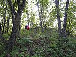
总体情况:关四周的石墙保存较好,为石块砌筑,形制较为清晰。北墙长23米,西墙长21米,南墙长22米,东墙长22米,东墙正中有一宽2米的门址,墙体残高1-3米。
附近遗存:关的西侧670米为图们微波站烽火台8号,东北侧600为图们微波站烽火台7号。地质、地形地貌:图们市位于吉林省东部,长白山脉东麓,地势西北和南部高,东部低,最高海拔为987米。
Type:关 Pass
Protection Level:省保
Content:
Memo:
Other Records:
Distribution:
visit location in Tianditu Map[recommend] Distribution:
visit location in Tencent QQ Map Distribution:
visit location in Google MapDistribution:
visit location in Baidu MapNational ID:222402353101150002
Action:[
 Save in Data Basket
 ]
Picture:
Click the thumbnail to view the Big Pic. Click the Big Pic to Hide the Big Pic![Caption:图们微波站关
loading images --Please wait...]()
![Caption:图们微波站关
loading images --Please wait...]() Photo Links
Photo Links:
 Search ::
  My Data Basket ::
  Favorite/My Favorite :: Recent Changes :: :: Login
 Save in Data Basket ]
